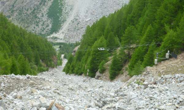
Every year in the Swiss Alps you can hear the sound of debris flows with thousands of tonnes of detritus rushing down into valleys, and towards endangered transportation routes and settlements. The Swiss Federal Institute for Forest, Snow and Landscape Research (WSL) uses SICK's 2D laser scanners in order to facilitate research to determine when, where, and how debris flows occur. Debris flow in Randa/Switzerland[/caption] Debris flows are spectacular and brutal events, says Dr. Lorenz Maier from the Swiss Federal Institute for Forest, Snow and Landscape Research (WSL) when describing the mixture of water, mud, and rock that slides into valleys in stream beds or natural gullies, heedless of any obstacles. In the space of just a few minutes, these events can transport tens or even hundreds of thousands of tons of mud, boulders, rock, and other objects such as tree trunks into valleys with considerably greater energy than that unleashed in a flood. The full force of a debris flow can completely destroy houses, transportation routes, and bridges.
2D laser scanner analyses debris flows in real-time
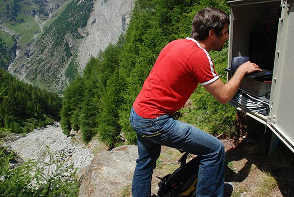
It is therefore useful to be able to recognize and map debris flow hazard zones. To do this, science relies on models to aid in simulating debris flow levels, speeds, and propagation, explains Dr. Meier. At the same time, these models must be verified using valid measurement data. Dr. Lorenz Meier configuring the 2D laser scanners
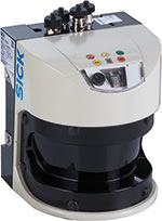
 SICK's LMS511 2D laser scanner is particularly helpful in this regard, since it allows us for the first time to perform high-resolution temporal and spatial measurements of debris flows while they are moving into valleys. Two sensors, placed approximately one meter apart, take these measurements. When a debris flow begins, a vibration measurement system above the measurement area activates the sensors by radio so that they each record a cross-section.
A high-wire act above the debris flow channel
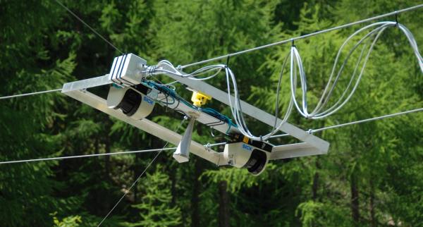
A special installation is used to ensure that the sensors do not fall victim to the unbridled forces released by the debris flow. We hung both SICK LMS511 units on steel cables above the Dorfbach debris flow channel near Randa in the canton of Valais. Cross-sections, recorded at a sampling frequency of 50 Hz, are transmitted from this location over an approximately 100 meter long Ethernet cable along the steel cable to a small Linux server at the edge of the channel, where they are stored and processed. The power supply for the sensors and the server is provided by solar panels and buffer batteries. LMS511 on steel cables above the debris flow channel
Breaking new ground without risk thanks to testing devices
This debris flow measurement has allowed the Institute to break significant new technological ground. How precise would the measurements be? How weatherproof are the sensors, which operate under conditions of continuous wind and weather, and which have to be transported in a large transport backpack by helicopter to the installation site? To clarify these and other questions in the run-up to the project implementation, SICK supported WSL by providing LMS511 units for testing purposes. After performing tests in our laboratory and carrying out the initial operations with the sensors, it quickly became clear that laser technology - particularly SICK's laser measurement systems - was ideally suited to our project, recalls Dr. Meier. The system installed above the Dorfbach channel near Randa in the canton of Valais has proven its value. In the meantime, plans are being made for a second, similar system to be installed at a larger channel, the Spreitgraben near Guttannen in the Bernese Highlands. For this project, we will switch to the LMS511's high-resolution model with a smaller light spot size and even finer resolution, so that we can detect and analyze even smaller surface details.
- Product information: LMS511 2D laser scanner
- Product portfolio: 2D laser scanners
- Customer information: Swiss Federal Institute for Forest, Snow and Landscape Research

